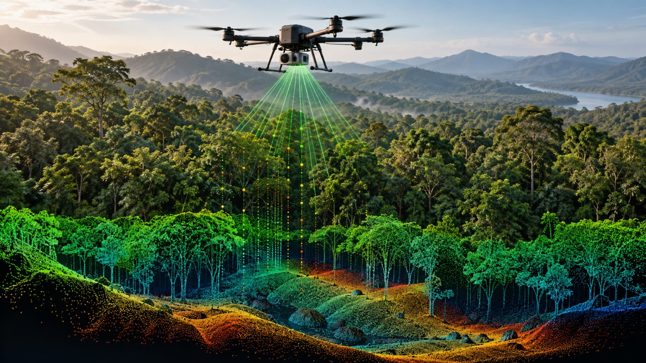
The laser measures distance, not just colour
A normal drone camera records reflected light and turns it into photographs. LiDAR works differently. A LiDAR sensor sends rapid laser pulses toward the surface and measures how long they take to return. Knowing the speed of light and the travel time lets the system estimate the distance to the reflecting object.
As the drone moves, thousands or millions of these measurements can be combined into a three-dimensional point cloud. Each point represents a measured location in space.
That difference matters in places where a photograph cannot easily distinguish the forest canopy from the terrain below it. LiDAR is measuring distance to surfaces rather than relying only on visible texture.
Can it really see through trees?
“See through” is useful shorthand, but it does not mean a LiDAR laser passes cleanly through a forest.
A pulse can encounter leaves, branches and trunks before some of its energy reaches lower layers. Multiple returns can therefore describe different parts of the forest. Some measurements come from vegetation while others can come from the ground through gaps in the canopy.
Research comparing UAV LiDAR with drone photogrammetry in forested terrain found that LiDAR maintained much better ground coverage as branch density increased. In one dense young-forest site, photogrammetric terrain coverage was about 80.7%, while the LiDAR system achieved almost 100% coverage. The study also showed why multiple or last returns are important: in the densest vegetation, only a small share of ground points came from first returns.
The result is not a perfect picture of everything beneath every tree. Occlusion still occurs when vegetation blocks the laser. But the ability to collect ground returns through gaps is one of LiDAR's major advantages for forest terrain mapping.
Turning point clouds into a terrain map
The raw output from a LiDAR survey is a point cloud, not a ready-made map.
Processing software first needs to distinguish ground points from vegetation and other objects. Once non-ground points are filtered, the remaining measurements can be used to build a Digital Terrain Model, or DTM, representing the shape of the land surface.
A UAV-LiDAR field study demonstrated this workflow in forest terrain: ground returns were separated from tree points and used to produce a high-resolution terrain model for landslide analysis.
This can reveal features that are difficult to measure from a normal aerial image, including slopes, drainage patterns, depressions, ridges and changes in terrain beneath vegetation.
Where forest LiDAR is useful
The same data can support several types of work.
Forestry teams can use three-dimensional measurements to estimate tree height, canopy structure and vegetation density. Terrain models can support landslide assessment, watershed analysis and planning in rugged areas. Surveyors can use the data to understand terrain where ground access is slow or difficult.
Recent UAV-LiDAR research has also examined understory vegetation itself. A 2026 study found that penetration capability had a greater influence on understory-structure estimation accuracy than point density, showing that simply increasing the number of laser measurements does not solve every forest-mapping problem.
This is important for interpreting LiDAR results: more points are useful, but where those points come from and what the laser was able to reach are equally important.
Why a LiDAR drone costs more than a camera drone
The biggest practical difference is the sensor package.
A camera drone can use a relatively compact imaging payload. A survey-grade LiDAR system adds a laser scanner, positioning and inertial equipment, and processing requirements. Accurate georeferencing often depends on GNSS, RTK or PPK positioning and an inertial measurement system so that each laser return can be placed correctly in three-dimensional space.
The data pipeline is also more demanding. Instead of producing a familiar photograph, the survey generates a large point cloud that needs classification, filtering and quality control.
That makes LiDAR-equipped drones more expensive to buy, operate and process than ordinary camera drones. The extra cost is justified when the required measurement cannot be obtained reliably with photography alone.
For India, where forest surveys, terrain mapping, infrastructure planning and geohazard assessment can involve large or difficult-to-access areas, that distinction matters. LiDAR is not simply a better camera. It is a different measurement system designed to answer questions about three-dimensional structure and terrain.