Robots rely on sensors to understand their surroundings, detect obstacles and plan safe routes. However, smoke, fog and heavy rain can interfere with these systems. Airborne particles scatter light, water droplets distort measurements, and important landmarks become difficult to identify. Combining multiple sensors can improve navigation, but robots must recognise when their information becomes unreliable.
Why Cameras and LiDAR Struggle
Optical cameras depend on reflected light to capture images. Fog, smoke and rain scatter or absorb some of this light, reducing contrast and making objects harder to recognise. Water droplets on camera lenses can further obstruct visibility.
LiDAR faces similar problems. It sends laser pulses and measures their return to calculate distances. In poor visibility, particles can scatter the pulses before they reach the intended target, producing missing points, weak returns or misleading measurements.
The impact depends on particle density, wavelength, sensor design and distance. A 2023 field study published in Sensors found that LiDAR detection performance varied significantly under different rainfall and fog conditions. Therefore, advertised sensor ranges do not guarantee reliable performance in severe weather.
Why Radar Helps, But Not Always
Radar uses radio waves rather than visible or near-infrared light, giving it advantages in many smoky and foggy environments. It can also estimate the speed of moving objects using the Doppler effect.
However, radar does not provide the same detailed environmental information as high-resolution cameras or LiDAR. It may struggle to distinguish closely spaced objects, identify small obstacles or describe complex shapes. Heavy rain can also weaken radar signals and introduce unwanted returns, depending on operating conditions.
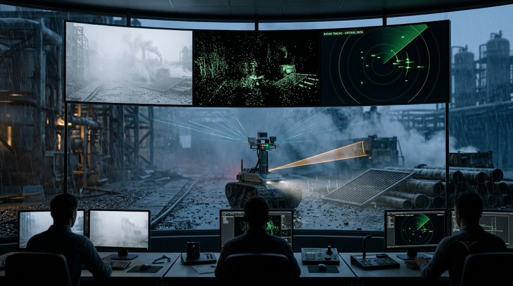
Newer 4D imaging radar systems provide additional information, including elevation and object movement. Research combining LiDAR with 4D radar suggests that integrating their measurements can improve perception in challenging weather. However, results depend on the particular system and testing conditions.
Can Thermal Cameras See Through Smoke?
Thermal cameras detect infrared radiation associated with temperature rather than relying on ordinary visible-light images. They can help identify people, hot objects and fire-related features when conventional cameras struggle.
Nevertheless, thermal imaging is not a complete solution. Dense smoke, hot gases and atmospheric distortion can reduce image quality. Thermal cameras also do not automatically provide the accurate depth information required to identify every safe path.
A February 2026 arXiv study on fire-aware navigation explored thermal sensing for mapping and robot movement in hazardous environments. It highlighted an important challenge: identifying objects is not the same as determining which areas are safe to travel through. The research was presented as a proof of concept rather than a universally validated navigation system.
Sensor Fusion: Powerful, Not Magic
Sensor fusion combines information from different devices to create a more useful picture of the environment. A robot might use LiDAR to estimate distances, radar to track moving objects and an inertial measurement unit to estimate its movement.
Researchers have tested LiDAR and radar combinations for robot localisation in artificial fog. Other studies have explored adaptive methods that adjust how sensor data are combined when visibility deteriorates. Systems combining LiDAR, thermal imaging and inertial sensing have also shown potential in degraded environments.
However, adding sensors does not automatically make a robot reliable. The system must assess each measurement's quality, align information accurately and handle conflicting readings. If several sensors are affected by the same conditions, important gaps may remain.
Navigation Must Account for Sensor Failure
A robot can calculate a valid route while still choosing a dangerous path. If smoke hides a doorway or rain creates misleading sensor returns, its internal map may no longer represent reality accurately.
Degradation-aware navigation addresses this problem by estimating sensor reliability during operation. A robot might slow down, rely more heavily on another sensor, take another measurement or request human assistance when confidence becomes too low.
This approach requires accurate calibration, synchronised sensor data and clear safety rules. In hazardous environments, stopping safely can be better than continuing with unreliable information.
What Operators Should Consider
Before deploying robots in poor visibility, operators should check which sensors are installed, what conditions the system has been tested under and how it responds when sensors disagree. Real-world trials are more informative than manufacturer specifications alone.
Smoke, fog and heavy rain reveal the limits of robotic perception. Cameras and LiDAR can lose detail, radar may miss fine structures, and thermal imaging cannot always identify safe routes. The goal is not simply to equip robots with more sensors, but to help them recognise uncertainty, adapt their navigation and stop safely when conditions exceed their capabilities.