What Happens When a Drone Loses GPS?
A drone flying smoothly over an open field can appear to know exactly where it is. Then it enters a building or slips underneath a bridge, and the satellite signal may no longer provide a useful position. The drone has not suddenly become blind—but it has lost one of its most convenient reference points.
This situation is known as GPS-denied, or more broadly GNSS-denied, navigation. GNSS is the larger family of satellite-navigation systems that includes GPS, Galileo and other constellations. Research on UAV navigation identifies GPS-denied environments as a major challenge because indoor spaces, urban canyons and some obstructed environments can prevent reliable satellite positioning.
The answer is not a single replacement for GPS. Instead, drones can combine several imperfect sensors to estimate their movement.
Cameras Can Measure Movement
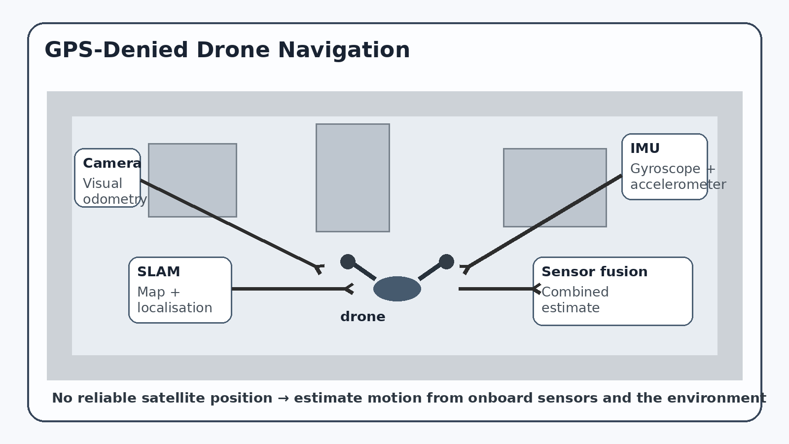
One important technique is visual odometry. In simple terms, the drone's camera watches how features in the environment move from one video frame to the next.
Imagine looking at a row of windows while walking down a corridor. The windows appear to shift across your field of view as you move. A computer can track distinctive points—corners, edges or other visual features—and use their movement to estimate how the camera has moved.
Drones can perform the same calculation at high speed. Research systems have demonstrated visual-inertial navigation for micro aerial vehicles operating in GPS-denied environments using commercially available cameras, inertial sensors and onboard computing.
The catch is drift. Small errors in every movement estimate accumulate. A drone may know that it has moved forward, but after hundreds of estimates its calculated position can gradually diverge from its actual position.
Why Inertial Sensors Matter
This is where the IMU, or inertial measurement unit, becomes important.
An IMU normally contains accelerometers and gyroscopes. Accelerometers measure changes in acceleration, while gyroscopes measure rotation. These sensors operate extremely quickly, making them useful for estimating the drone's motion between camera observations.
But an IMU has its own problem: small measurement errors accumulate when motion is calculated over time.
The solution is therefore often sensor fusion—combining different measurements so that one sensor can compensate for another. A camera provides information about the surrounding scene, while the IMU provides rapid information about movement and rotation. Modern research systems combine these measurements in visual-inertial odometry and SLAM systems.
SLAM Gives the Drone a Map
SLAM stands for Simultaneous Localization and Mapping. The name describes its two jobs: the drone tries to determine where it is while simultaneously constructing a map of its surroundings.
Consider a drone entering an unfamiliar warehouse. Its camera detects features such as walls, corners and machinery. As the drone moves, the system estimates its position and builds a representation of the environment. If it later recognises a place it has already visited, that loop closure can help correct accumulated drift.
Research systems such as ORB-SLAM3 combine visual and inertial information and have been tested in both indoor and outdoor environments. These are research technologies and software frameworks, rather than evidence that every commercial drone can independently navigate any GPS-denied environment.
Indoor and Urban Spaces Are Still Difficult
GPS-denied navigation becomes difficult precisely where the environment becomes complicated.
A dark corridor provides little useful visual information. A plain white wall may contain too few distinctive features. Repeating windows or identical rooms can confuse feature-matching algorithms. Fast flight can create motion blur. Moving people, vehicles or machinery can introduce features that do not belong to the stationary environment.
Urban areas create another problem. Tall buildings can obstruct satellite signals, while reflections can degrade positioning. Recent research continues to investigate vision-based localisation specifically for urban and other GNSS-denied environments.
There is also a fundamental difference between local navigation and global positioning. A drone may successfully estimate that it has moved two metres to the left without knowing exactly where that location is on Earth.
That is why GPS-denied navigation is better understood as a layered system rather than a magic replacement for GPS. Cameras, IMUs, LiDAR, range sensors and algorithms such as SLAM can work together—but their reliability depends heavily on the environment.
For India, this matters in practical settings ranging from indoor inspection and search-and-rescue research to drones operating beneath bridges or around dense urban infrastructure. A 2023 research project from Hyderabad, for example, investigated sensor fusion for autonomous indoor UAV navigation using depth sensing, IMU data and LiDAR.
The important point is simple: when a drone loses GPS, it does not automatically know where it is. It has to estimate its position from evidence—and every piece of evidence has limitations.