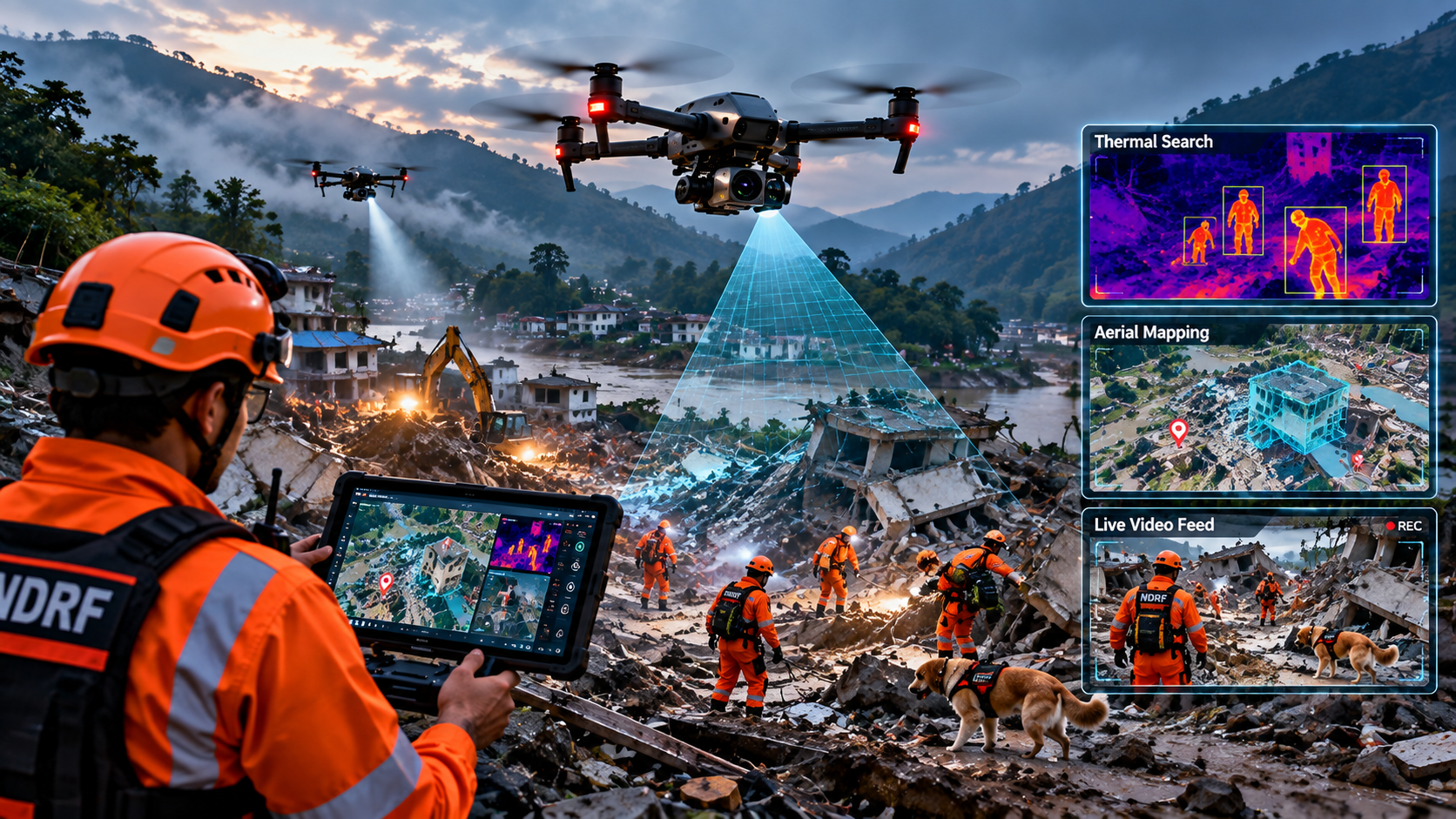
The drone’s real advantage is time
A missing-person search often begins with incomplete information: a last known location, a vehicle, a phone signal or a description of the terrain. A conventional ground search can be slowed by cliffs, dense vegetation, floodwater, unstable structures and darkness. A drone changes the geometry of the problem by giving rescuers an elevated view before people commit to a route.
That does not make the aircraft a stand-alone rescue system. The useful output is information: a likely location, a map of an unsafe area, a view of a flooded road, or a live picture that lets a commander decide where to send people next. In that sense, the drone is best understood as a fast reconnaissance layer inside a wider incident-management system. NIST first-responder testing explicitly combines aerial sensing with communications and location data, while emergency services describe drones as tools for situational awareness and safer decision-making.
Thermal cameras turn darkness into a searchable landscape
Visible-light cameras are valuable during daylight, but thermal cameras detect differences in infrared radiation rather than relying on reflected visible light. A person can therefore stand out against cooler ground or vegetation, particularly when the scene has useful temperature contrast.
Thermal imaging is especially useful at night and in visually cluttered areas. The U.S. National Park Service has documented a missing-hiker search in Colorado National Monument in which a specially licensed drone with thermal imaging and cameras was used during night operations in rough canyon terrain. NIST’s first-responder work likewise describes thermal-equipped UAS being used to scan large areas and return images with location information.
Thermal does have limits. It can be affected by weather, terrain, vegetation, distance and the temperature of surrounding objects. A thermal camera can flag a heat signature; trained personnel still need to interpret the image and confirm what it represents.
Night operations reduce the penalty of waiting for daylight
A search does not always stop when the sun goes down. Drones equipped with thermal sensors, low-light cameras, spotlights and obstacle-avoidance systems can continue reconnaissance while ground crews remain focused on safe movement. Fire and rescue services now describe these combinations as useful for missing-person searches, incident assessment and low-light operations.
Night flying also raises the stakes. Power lines, trees, buildings and terrain become harder to see, and a drone operator has to manage navigation, battery reserves and communications at the same time. NIST’s night-search test scenarios include obstacles such as roofs, trees, shrubs and power lines, illustrating why night rescue is not simply daytime flying with a thermal camera switched on.
Mountains and rough terrain are where aerial access matters most
In mountainous country, a few hundred metres on a map can represent a long and hazardous journey on foot. Cliffs, gullies and scree can hide a person from rescuers below while making direct access slow. A drone can inspect ledges, ravines and canyon floors from several angles without putting a searcher into the same exposure.
The Grand Canyon National Park example is a useful illustration of the human-machine relationship: the rescue operation involved trained personnel in difficult terrain, while the drone operator worked as part of that wider effort. The aircraft can search a large area, but people remain responsible for deciding how to approach a subject and how to conduct the rescue itself.
Flood response: mapping first, rescue decisions second
Floods create a different search problem because roads disappear, water can be moving quickly, and buildings may be inaccessible. A drone can provide an overhead picture of flooded streets, isolated roofs, breached banks and changing water conditions. USGS research describes small uncrewed aircraft as a way to collect rapid aerial flood data for decision support, while the agency has also trained pilots specifically for emergency flood-response measurements.
In a rescue context, the drone can help identify where people are stranded and which routes are open to boats or ground teams. NIST’s aerial-drone testing includes flooded houses, people in or near water, collapsed bridges and the identification of survivors using visual or thermal information. The important insight is that aerial imagery can connect individual observations into a common operating picture for the incident team.
Locating missing people is increasingly a data problem
Modern rescue drones do more than record video. Systems can transmit live feeds, attach coordinates to images and, in some deployments, combine visible and thermal imagery with automated detection tools. NIST has demonstrated systems that save geo-tagged images for later analysis and use onboard communications to send data back to first responders.
This matters because a search team may have more imagery than a human operator can examine in real time. Automated detection can help prioritize frames or locations, but it should be treated as decision support rather than proof of a sighting. A false positive can waste scarce rescue time; a false negative can be even more serious. Human verification remains central.
Coordination is where the technology becomes operationally useful
The strongest rescue-drone programs are integrated into the command structure rather than operated as an isolated camera team. Footage may be streamed to an incident commander, shared with police or fire services, or combined with maps and other sensor information. Some fire services use dedicated platforms for live streaming, thermal imagery and communication with commanders.
That coordination also affects airspace and safety. Rescue operations can involve helicopters, aircraft, power lines, crowds and multiple drone teams. A clear launch authority, communications plan, flight area, battery plan and handoff procedure can be as important as the aircraft itself. The drone should reduce uncertainty for the team, not add another unmanaged information stream.
What drones cannot solve
A drone cannot reliably see every person through dense vegetation, water, roofs or terrain. Thermal signatures can be ambiguous, and bad weather or wind can limit flight. Batteries impose a finite search window, especially when a drone carries a heavy camera, spotlight, speaker or other payload.
The practical model is therefore complementary: drones extend the eyes and ears of rescuers, while trained teams provide confirmation, medical aid, extraction and accountability. Their greatest contribution is often not a dramatic rescue captured on video, but a quieter operational gain—helping commanders decide where not to send people, where to send them first, and how conditions are changing.
The broader lesson: search-and-rescue is becoming more aerial and more connected
The technology is moving from simple aerial photography toward integrated sensing, mapping and communications. Thermal cameras, optical zoom, low-light systems, live links, automated image analysis and 3D mapping can give responders a more complete picture of an incident.
The next step is not simply making drones fly farther. It is making the information they collect easier to trust, share and act upon. For rescue organizations, that means testing aircraft in realistic terrain and weather, training pilots alongside incident commanders, and building procedures for data sharing and safe integration with other responders. The drone is most valuable when it becomes part of the team’s workflow rather than a separate gadget.