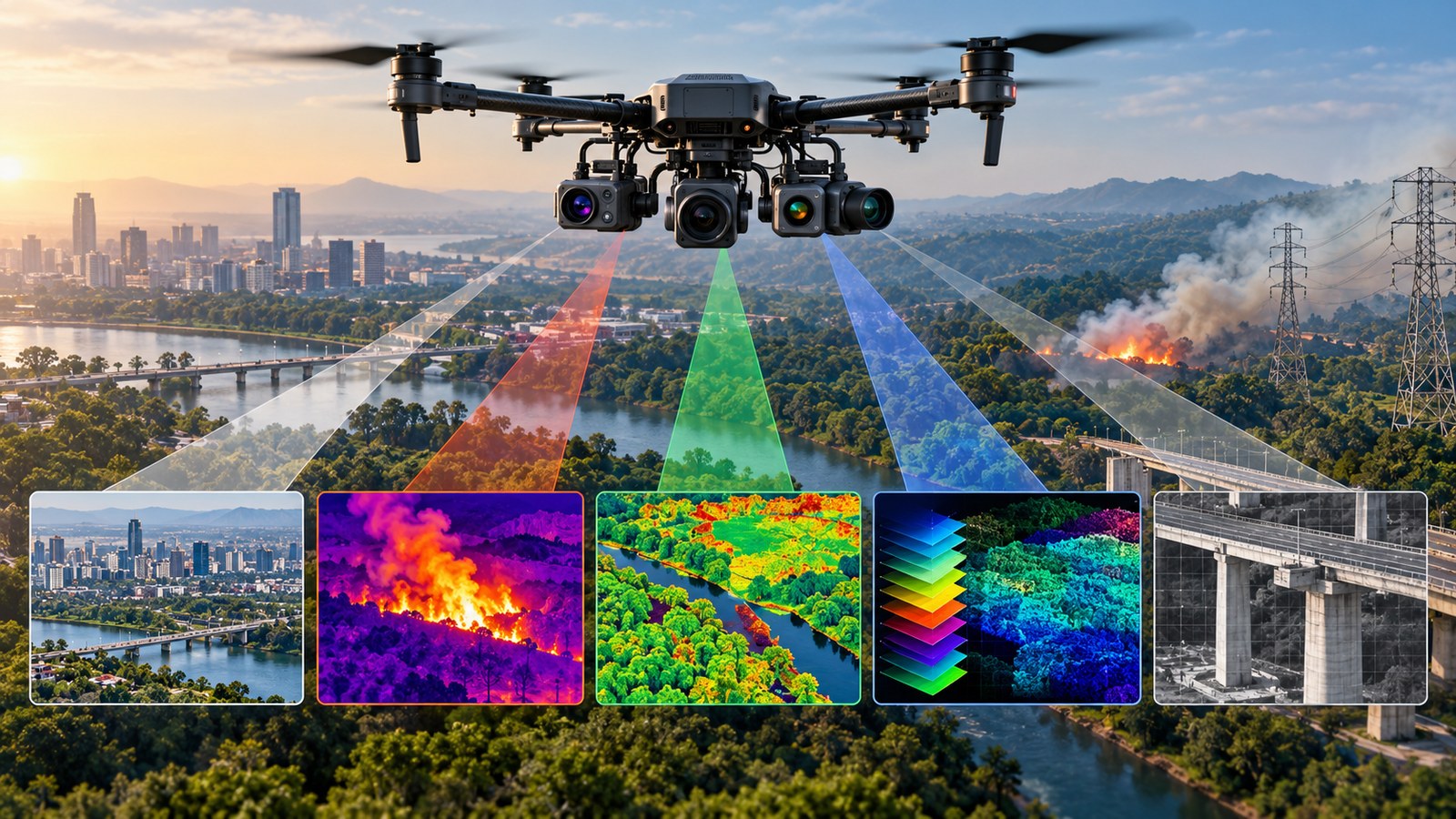
The ordinary camera is only the starting point
A drone camera does not have to reproduce human vision. RGB cameras record red, green and blue visible light, while other sensors can detect heat, selected wavelengths or distant detail. A thermal camera can look for heat. A multispectral sensor compares several wavelength bands. A hyperspectral sensor measures many narrow bands. A zoom camera resolves distant objects without requiring the drone to fly close.
These sensors are not interchangeable. Each produces a different type of evidence, so the right camera depends on the question an operator needs to answer.
RGB and zoom cameras: detail that is easy to understand
RGB imagery remains the workhorse because it produces photographs that people can interpret quickly. It is used for mapping, construction, inspection, documentation and public safety. Zoom cameras solve a different problem: distance. Optical zoom lets an operator examine a distant structure or target while keeping the aircraft farther away. Indian government UAV specifications have included stabilized day/night payloads with 30x optical zoom for surveillance.
The limitation is straightforward. Zoom does not reveal a new physical property; it mainly provides more detail from farther away. If the target is hidden by smoke, darkness or vegetation, visible-light imagery can still struggle.
Thermal cameras: finding heat instead of colour
Thermal cameras detect infrared radiation associated with temperature and convert it into an image. In firefighting, thermal imagery can reveal hotspots and help identify areas that remain hotter than their surroundings. The FAA describes UAS use in wildfire response for hotspot detection, fire-perimeter mapping and situational awareness. India's NITI Aayog drone module also lists firefighting, forest-fire tracking and industrial inspection among thermal-sensor applications.
Thermal imaging is useful in inspection too. An overheating electrical component can appear as a temperature anomaly even when it looks normal in an RGB photograph. But thermal does not mean that a drone can see through everything: smoke, distance, surface properties and atmospheric conditions can affect the measurement.
Multispectral cameras: several useful bands
Multispectral sensors record selected wavelength bands beyond ordinary visible colour. USGS describes multispectral sensing as measurements in distinct wavelength bands. These additional bands can reveal patterns that colour photographs do not show clearly, especially in vegetation.
USGS has used UAS thermal imaging to count waterfowl while using five-band multispectral sensors to assess wetland habitat quality. That illustrates how sensors can complement each other: thermal helps detect animals while multispectral data helps describe the surrounding habitat.
Hyperspectral cameras: a detailed spectral fingerprint
Hyperspectral imaging goes further by measuring many narrow, closely spaced wavelength bands. USGS describes hyperspectral data as numerous contiguous bands, while NASA explains that spectral signatures can help distinguish materials that look similar in ordinary photographs.
For drones, this can support specialised work in vegetation analysis, mineral identification, environmental monitoring and research. A 2026 USGS field campaign used a drone carrying a hyperspectral sensor with 274 bands across visible and near-infrared wavelengths.
The trade-off is complexity. Hyperspectral systems generate large datasets and require calibration, processing and specialist interpretation, so they are not simply a higher-resolution RGB camera.
The camera choice changes the drone's job
A firefighting team may prioritise thermal imagery. A bridge inspector may need high-resolution RGB and zoom. A conservation project may combine thermal and multispectral sensing. A research team studying materials may need hyperspectral data.
In many cases, the most useful system is a combination of sensors. A visible image can provide context while thermal or spectral data highlights something the eye would miss. For India, this matters as drones move into agriculture, infrastructure inspection, disaster response, wildlife monitoring and public safety. The value of a drone is increasingly determined not only by how well it flies, but by whether its sensor produces the right evidence for the job.