Navigating by Sound, Motion and Memory: How Autonomous Underwater Robots Find Their Way Without GPS
GPS signals do not travel through water, so an underwater robot cannot check a satellite fix. One navigation paper says GPS underwater is mostly limited to surveying acoustic transponders or calibrating sensors. Another notes that radio signals are heavily absorbed, so most algorithms depend on inertial and acoustic signals. A September 2026 paper lists the main options as inertial estimates, acoustic positioning, geophysical information and SLAM, with visual odometry helping to reduce drift.
Dead Reckoning: Inertial Sensors and a Velocity Log
The standard setup for commercial AUVs is an inertial navigation system (INS) aided by a Doppler velocity log (DVL) that measures speed over the seabed. One paper reports positioning error below 1% by the end of a mission when a high-grade INS and a DVL are combined. Researchers have also shown that DVL calibration parameters can be tuned in the field without GPS or acoustic beacons.
The weakness is drift. Without fresh position measurements, the error of the estimate grows without bound. Dead reckoning without any transponder can drift considerably over time.
Acoustic Positioning: An “Acoustic GPS”
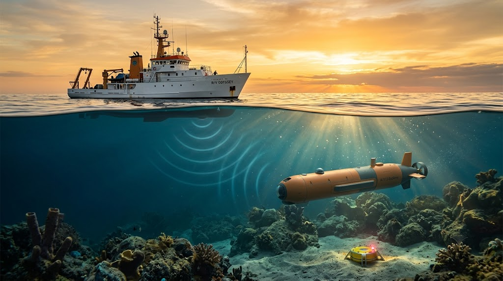
Sound travels well underwater, so most position fixes come from acoustics. Long-baseline (LBL) systems use seafloor beacons that trilaterate the vehicle’s position, much like an “acoustic GPS.” Short-baseline (SBL) and ultrashort-baseline (USBL) systems sit on a surface vessel and measure the vehicle’s range and bearing. These systems are accurate but expensive to deploy, and they limit where the vehicle can operate. A low-cost alternative uses a single transponder.
Sonar and Cameras: Navigating by What the Robot Perceives
Sonar lets a robot recognize its surroundings. A robotics paper says imaging sonars perform better than other acoustic sensors at object detection, collision avoidance and acoustic visual navigation. It adds that Kalman-filter methods have fused such sensors in harbors, marinas and ship-hull inspection. Side-scan sonar can also help: one method matches sonar detections to known landmarks to bound navigation error, though the system must work out which landmark produced each detection.
Newer work leans on software. A May 2026 chapter describes AI-aided sensor fusion that combines INS, DVL and cameras, and presents visual-inertial odometry as a backup when acoustic or DVL signals degrade. It also describes ResAlignNet, which needs only onboard INS and DVL sensors and no GNSS or acoustic infrastructure. Those are the authors’ own reported results.
Why It Remains Hard
Surfacing for a GPS fix is possible, but it cuts time underwater and restricts operating depth. Other challenges include strong currents, variable sound-speed profiles and limited visibility. Communication is also slow. In an MIT account of diver-and-robot teaming, sending an uncompressed image by acoustic modem would take tens of minutes at current data rates. The same account says the lack of large labeled sonar image datasets has held back training of underwater perception algorithms.
What Comes Next
Timing is one frontier. The Royal Navy and Infleqtion say they completed the first deployment of a quantum optical atomic clock on an AUV, aimed at navigation where GNSS is unavailable. They note that conventional microwave clocks can accumulate drift over time. A Royal Navy official described the trial as a first step toward understanding how such clocks could work on underwater platforms, so it is not yet an operational capability.