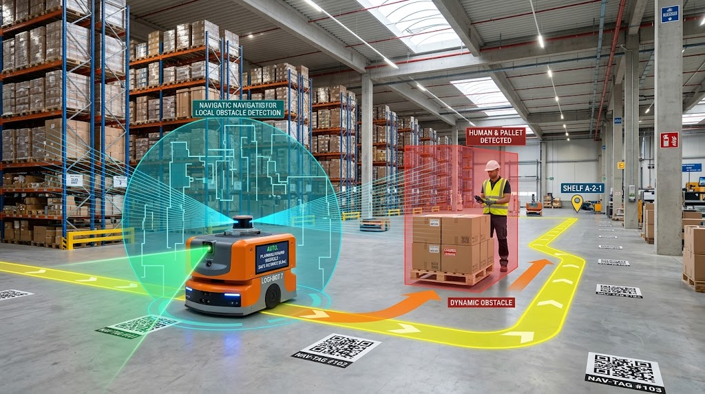
A Robot Needs More Than a Destination
Telling a warehouse robot to “go to shelf 42” sounds simple. The difficult part is knowing where shelf 42 is, where the robot is currently located and whether something is blocking the route.
Autonomous mobile robots (AMRs) solve this by combining localization, mapping, perception and path planning. Instead of treating the warehouse as an empty floor, the robot continuously builds an understanding of its surroundings and compares what its sensors see with that information.
Recent 2026 research on warehouse AMRs describes systems combining LiDAR, cameras, inertial sensors and other inputs to improve perception and navigation in changing environments.
LiDAR Helps Build the Map
LiDAR sends out laser pulses and measures how long they take to return after hitting objects. From these measurements, a robot can detect walls, racks, pallets and other objects around it.
During mapping, the robot can use LiDAR observations together with wheel movement and other sensor information to construct a map of the warehouse.
One important technique is SLAM — Simultaneous Localization and Mapping. In simple terms, SLAM helps a robot create or improve a map while also estimating its own position within that map.
Research on industrial transport robots has demonstrated LiDAR-based SLAM combined with wheel odometry and an inertial measurement unit to construct a two-dimensional map.
Cameras Add Information LiDAR Cannot See
LiDAR is useful for understanding shapes and distances, but cameras provide visual information.A camera can help a robot recognize objects, signs, shelves or markers. With computer vision, the robot may distinguish something that is simply an obstacle from something it needs to identify.
This is why modern navigation systems increasingly combine different sensors rather than depending on one source of information. A 2026 warehouse AMR study, for example, combined depth cameras, IMUs, LiDAR and ultrasonic sensing for environmental awareness and navigation.
QR Codes Can Give the Robot a Fixed Reference
Not every warehouse needs completely free navigation.Some systems use QR codes or other visual markers at known positions. When a robot detects a marker, it can use that known reference to correct or confirm its estimated location.
This can be particularly useful when a precise position is needed at a specific point. Research published in Scientific Reports demonstrated a localization approach combining sensor-based positioning with QR-code assistance to correct accumulated positioning error.
The trade-off is that markers have to be installed and maintained. If the warehouse layout changes frequently, a marker-based system may require additional infrastructure changes.
Navigation Is a Continuous Calculation
Knowing the robot's position is only half the problem. It also needs to decide where to move next.
The navigation system uses the map, current position, destination and detected obstacles to calculate a path. If a worker, pallet or another robot blocks the planned route, the robot may need to slow down, stop or find another path.
This is one reason AMR navigation differs from older guided systems that depend heavily on fixed routes. A 2026 review of warehouse AMRs identifies perception, localization, mapping, path planning and fleet coordination as interconnected parts of a complete warehouse system.
The important point is that a warehouse robot does not “know” its destination like a human does. It continuously estimates where it is, what is around it and how it can safely reach the next point.
That combination of sensors, maps and software is what turns a mobile machine into a navigating robot.